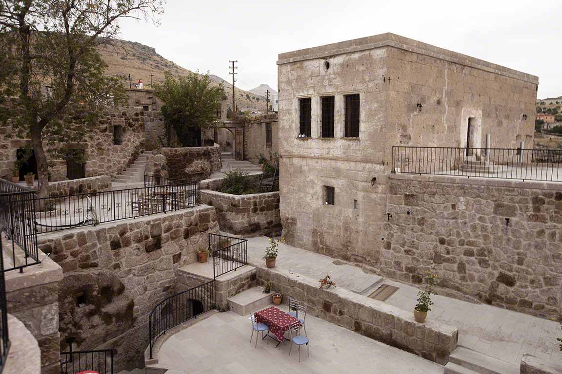
Tuesday, July 21, 2026

Türkiye | Kayseri | Seljuqs of Rum

Kayseri, in Cappadocia region of Turkey (click on images for enlargements)
Decamped from Istanbul and wandered off to the city of Kayseri 400 miles to the southeast, in the Central Anatolian region of Cappadocia. The flight, which took just little over an hour, was sold out. There were at least twenty-five Chinese tourists on board, most if not all bound for the famous nearby tourist towns of Urgup, Göreme, Guzelyurt, Uchisar, and others famous for their cave houses, fairy chimneys, and balloon rides. These and most other tourists were met by shuttle buses and whisked off to the tourist destinations. I caught a cab to downtown and was soon esconsced in a hotel a five minute walk from the Citadel in the middle of the city. Kayseri has a population of about 850,000 people. It is located at an altitude of 3482 feet. Fifteen miles to the south looms 12,847-foot Mount Erciyes, the eroded cone of a now dormant volcano.
12,847-foot Mount Erciyes
There has probably been some sort of settlement on the current site of Kayseri or nearby, closer to Mount Erciyes,  for at least 5000 years. The first recorded name of the town was Mazaka. After the armies of Alexander the Great swept through in the fourth century b.c. the region became Hellenized, and from about 250 b.c on the city became known as Eusebia. The city and the rest of Cappodicia recognized the suzerainty of the Roman Empire in the first century b.c. In 17 a.d. the region became a Roman province. The last king of Cappadocia, Archelaus (d. 17 a.d.), changed the name of the city to Caesarea in honor of Caesar Augustus, who had died in 14 a.d. The Arab general and later first Umayyad Caliph Muawiyah seized the city in 647 and Caesarea was soon Arabized into Kaisariyah. The Seljuqs of Rum, another Islamic dynasty, took control of the city in 1178 and Turkicized the name into Kayseri, the name it retains to this day. Thus the current name is a corruption of Caeser (Augustus), a Roman emperor.
The original Citadel in the middle of the city was built by the Byzantine (East Roman) Emperor Justinian (482–565; r. 527–565). Justinian also built the world-famous Hagia Sophia in Istanbul and married the notorious ex-prostitute and nymphomaniac Theodora. The Citadel later updated and enlarged by the Seljuqs and Ottomans.
Another view of the Citadel
Citadel and city walls
Top of the Citadel
The Citadel was the anchor of a much larger wall that surrounded the city. Most of the city wall is now gone, although one section does extend several blocks south of the Citadel. Here is the tower at the southeast corner of the old walled city.
Fascinating as Justinian-era citadels may be, the real reason I am in town is to see the surviving monuments of the Seljuqs of Rum period. The Seljuqs of Rum, as most of you know, were an offshoot of the Great Seljuq Empire founded in 1037. At its height the Great Seljuq dynasty controlled a vast swath of Asia from Afghanistan to the Black Sea, including the eastern shoreline of the Mediterranean, and from the Caspian and Aral Seas in the north to the Persian Gulf in the south. I had already seen the tomb of Sultan Sanjar, one of the great Seljuq rulers, in Merv, Turkmenistan, and the tomb of Tughrul III, the last ruler of the Great Seljuq empire, in Tehran, Iran, so of course I was eager to see the Seljuq of Rum monuments. 
Extent of the Great Seljuq Empire in orange
By 1193, however, the Great Seljuq Empire had collapsed, leaving only the rump in Anatolia known as the Seljuqs of Rum. The name “Rum” comes from the Persian word for the Roman Empire. The Seljuqs adopted the name because their sultanate had been founded on territories which had once belonged to the Roman, or Byzantine, Empire.
Territories of the Seljuqs of Rum in various shades of purple
The Seljuqs of Rum were an independent sultanate from around 1177 to 1243, when they were conquered by the Mongols, who had already established themselves in Persia to the east. From 1243 to the first decade of the fourteenth century the Sultanate remained under the suzerainty of the Mongols. Hereafter it broke up into a bunch of small independent emirates, or beyliks. In 1515 the city and region was finally incorporated into the Ottoman Empire.

Although Iznik and Konya were the main capitals of the the Seljuqs of Rum, Kayseri served at times as a temporary capital. Its strategic position at the crossroads of several great trade routes, including the Silk Road from the East, made it an important commercial center. The city’s wealth was responsible for the Seljuqs mosques, tombs, madrassas, bathhouses, and caravanserais that have survived to the present day and are among the city’s biggest attractions. 
Just cross the street from the Citadel is the Mahperi Hunat Khatun Mosque complex, commissioned by Mahperi Hunat Khatun, wife of the Seljuq Sultan Alaettin Keykubat (r. 1223-1237). Built in the years 1228-1237, it consists of a mosque, a madrassa, and a public bath.
Mahperi Hunat Khatun Mosque
Entrance to Mahperi Hunat Khatun Mosque
Detail of stonework on the entrance to the Mahperi Hunat Khatun Mosque
To the left of the mosque is the madrassa of Mahperi Hunat Khatun. The interior courtyard now serves as a charming tea house, serving doddering old graybeards, school girls, and wanderers alike. Comfortably shaded by canvas awnings, the teahouse was a welcome shelter in the afternoons, when temperature were still hitting the mid-90s during the first week of September (my only compliant would be that they serve tea in paper cups instead of glasses). The cells of the former madrassa students that line the courtyard are now shops telling paintings and other local artworks and crafts. 
Front of the Mahperi Hunat Khatun Madrassa, now a tea house
Entrance to the Mahperi Hunat Khatun Madrassa
The Çifte Madrassa, or Twin Theological Schools, was built in 2005 by Seljuk Sultan Giyaseddin Keykhüsrev I in memory of his sister Gevher Nesibe Hatun. It originally served as a medical center complete with a room for surgeries and also, apparently, served as a medical school. It was considered one of the most advanced medical facilities of the thirteenth century. Sound ducts carried music thought to be conducive to healing into the rooms of patients, and medicinal herbs and vegetables for patients’ meals were grown on the grounds. It accepted all in need—Muslim, Christian or Jewish, Greek or Turk—and did not charge those who were unable to pay.

The madrassa now hosts the small but surprisingly well appointed Museum of Seljuq Civilization, complete with state-of-the art multi-media displays. One room features a map of the city on the floor. As you follow a path marked out on the map video screens show what you would be seeing if you were actually walking through the city. First the area is shown on a satellite image (looks like Google Earth), then the view zooms in on an important Seljuq building in the neighborhood, finally focusing in on the architectural details. As you walk through a corridor connecting two courtyards sensors in the floor turn on the “Sounds of Thirteenth Century Kayseri” played through speakers discreetly hidden in the ceiling. All I heard was a call to prayer, which of course can still be heard five times a day in Kayseri. I would have preferred to hear some sultry Seljuk siren say, “Hey big boy, looking for some company?” One of the courtyards hosts a tea room, thank goodness, for the 95º F heat was severely dehydrating me. Admittedly, very few of the displays have descriptions in English. But if you are blind, you are luck; many of the displays have descriptions in Braille. Next to some of the Braille descriptions small artifacts tethered on cords have been placed to that blind people can feel them.
Front of the Çifte Madrassa
Entrance to the Çifte Madrassa
Inscription about the entrance to the Çifte Madrassa
The Sahibiye Madrassa dates to 1267, after the Seljuqs of Rum had recognized Mongol suzerainty. It was commissioned by Fakhr al-Din Ali, a.k.a Sâhib Ata or Sâhip Ata, who held a number of important post in the Seljuq government under ruler Sultan Keykhüsrev III. He was famous for the charitable foundation he had set up throughout the Seljuq realm; the Sahibiye Madrassa was another of his contributions. The interior of the madrassa now serves as a book bazaar. 
Old and New: The Sahibiye Madrassa in the foreground and the Kayseri Hilton in the back.
Entrance to the Sahibiye Madrassa 
Detail of entrance to the Sahibiye Madrassa 
Detail of entrance to the Sahibiye Madrassa
Hacı Kılıç Mosque, dated to 1249, after the Seljuqs of Rum had recognized Mongol suzerainty. 
Entrance to the Hacı Kılıç Mosque
Detail of entrance to the Hacı Kılıç Mosque
Another entrance to the Hacı Kılıç Mosque
Detail of other entrance
 Lala Muslihiddin Pasha Mosque. Lala Muslihiddin was an important figure in the Seljuq government, but is it not quite clear when he lived. He apparently commissioned this mosque and a tomb for himself. 
Mausoleum, apparently of Lala Muslihiddin, associated with the mosque.
An impressive Seljuq monument known as the Döner Tomb. It is not quite clear who was entombed in it. 
 The Döner Tomb
Detail of the Döner Tomb. Note the Tree of Life motif. 
The Han Mosque. Built by the Seljuks originally as a caravanserai, it was later converted into a mosque. 
The Emir Han Tomb, connected with the Han Mosque. It was built in 1189 as a tomb for the Emir Cemaleddin Tanrivernis Bin David. It also contains the bodies of two other members of his family.

Alaca Tomb. Built in the thirteenth century for the emirs Cemalettin and Bin Muhammad.

The post-Seljuq-era monuments in the city include the tomb of Zeynel Abidin. A prominent member of the Rufayi Sufis, Zeynel Abidin, a.k.a. Imam Sultan (d. 1414), commissioned a mosque, a dervish lodge, and a fountain near the current site of his tomb. All these structures are now gone. The building which houses his tomb was not built until 1886. The tomb is still an important pilgrimage site. Many people come here to pray before the tomb of  Zeynel Abidin. I had to return five or six times before I found the building empty and could take a photo.
Mausoleum of Zeynel Abidin
Tomb of Zeynel Abidin
And of course the world-famous Ottoman architect Mimar Sinan (c. 1492–1588) was born in Kayseri. Responsible for the Süleymaniye Mosque in Istanbul and hundreds of other mosques, madrassas, and other buildings and structures, he must rank as one of the most prolific and influential architects of all time. (For an entertaining novelistic account of the world around Sinan see The Architect's Apprentice by Elif Shafak.)
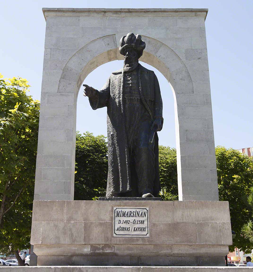
Statue of Mimar Sinan
Mimar Sinan did build one mosque in his hometown. Originally called the Hadji Ahmet Pasha Mosque, it was completely in 1573. It later became known as the Kursunlu Mosque. The difference in style from the Seljuq mosques could not be more obvious. 
Kursunlu Mosque

Monday, July 20, 2026

Türkiye | Cappadocia | Göreme | Balloon Flight

Whenever I strike up a conversation with anyone in Göreme, the first question they ask is, “have you taken a balloon ride?” l quickly discovered that balloon rides are the main reason people come here. I talked to three people, two women and a man in their mid-twenties from Belgium, who had flown to Istanbul in the morning and then taken the 5:10 p.m. flight to Kayseri. From the Kayseri airport they took a bus to Göreme, where they stayed the night. They got up the next morning at 4:30 for a balloon flight and after the balloon flight went on the so-called Red Tour of the Cappadocia region, leaving Göreme at 9:30 a.m. and returning at 6:30 p.m. Then they took  the bus back to Kayseri, where they caught the 11:00 p.m. flight back to Istanbul. They planned to stay two days in Istanbul for a little shopping and sight-seeing and then fly back to Belgium. They claimed that the entire trip was planned around the balloon flight. Seeing as how everyone else was taking balloon rides it seemed downright churlish of me to come to Göreme and not take one myself. So I signed up for a flight.

There must be at least fifteen or twenty companies offering balloon flights in Göreme and competition between the various operators is fierce. I shopped around for a discount and, oddly enough, found one with a company that I later discovered is one of the most highly regarded in the region. The companies have this thing organized to the T. They pick you up at your hotel at 4:30 in the morning and whisk you to their offices, where a buffet breakfast is served. Then you are driven in a van to the take-off point, which apparently varies according to the winds that day. My company had two balloons taking off that morning, one with a 8-person gondola and one with a 16-person gondola. I had been told the 8-person gondola offered more space to maneuver for photos and a generally less crowded experience, but it also cost more. I signed up for the balloon with the 16-person gondola. As it turned out, there were only ten people in the gondola, so we actually had more space per person than the people in the 8-person gondola, which was full. On my ride were people from Turkey, France, Italy, China, and Korea.

Our pilot said he had no control over the direction the balloon took. We simply had to go with the prevailing breezes. But at different altitudes the breezes blew in different directions, so we could control our flight path somewhat by changing altitude. First we started out fairly low and drifted north-northeast over the village of Çavuşin, at the western end of the Red Valley. 
Our takeoff point. Several other companies were using the same site (click on photos for enlargements).
Drifting off towards Çavuşin, with the cliffs lining the Red Valley in the distance.
Drifting off towards Çavuşin
The village of Çavuşin.
Cave dwellings in the cliffs above Çavuşin
Cliffs over the village of Çavuşin.
Then we rose in altitude to catch the slight wind to the southwest. Soon we were approaching the village of Uchisar. 
Village of Uchisar in the distance
Village of Uchisar
Then we dropped in altitude and again drifted to the north, above the Love Valley.
The Love Valley
Actually I had walked to Love Valley from Göreme two days before.
Love Valley from ground level
Love Valley  from ground level
 Love Valley from ground level
Another view of Love Valley
Then we drifted over the White Valley
White Valley
Approaching our landing site
Before taking off the pilot had given us instruction on what to do in case of a hard landing. In the event it was not necessary. You could have put a full cup on coffee on the railing of the gondola before takeoff and not spilled a drop on the entire flight, including the landing.
The pilot landed the gondola directly on the blue trailer.
Happy ballooners preparing for the traditional post-flight champagne toast.

Türkiye | Cappadocia | Güzelyurt

After viewing the Super Bloodmoon in Göreme I wandered off to the town of Güzelyurt, thirty-five miles to the southwest. Güzelyurt, as you probably know, was once the home of Gregory of Nazianzus, a.k.a. Gregory the Theologian (c. 329–390), who is credited, along with St. Basil of Kayseri, with laying the theological foundations of the Greek Orthodox Church. Gregory himself was largely responsible for formulating the Christian concept of the Holy Trinity—Father, Son, and Holy Ghost—that continues to befuddle the less enlightened right down to the present Day. 

Güzelyurt (roughly translated as “beautiful home”), population about 3,750, could hardly be more different than Göreme. While Göreme supposedly has a permanent population of only 2000, it has some 370 hotels, guesthouses, and hostels (many of the employees of the hotels, restaurants, shops, etc. live in nearby towns). It is an international tourism hub teeming with visitors of every stripe. Güzelyurt, on the other hand, is a laid back old-fashioned Turkish town that appears to have not a single restaurant or shop that caters specifically to tourists. There are a dozen or so hotels, most of them occupying old Greek mansions or cave dwellings, but they have their own restaurants where their clientele eat. I saw a couple of Russians, a couple of Germans, and a group of Chinese, but I would say ninety per cent of the tourists are from other parts of Turkey.
The main street of laid back Güzelyurt (click on photos for enlargements)
The town square. This photo was taken early in the morning. Later the tables are filled with local tea-coolers. 
My hotel
Another view of my hotel
Patio of my hotel
My hotel from the bottom of the canyon
The town is centered around Monastery Valley, a high-walled valley—or a low walled canyon—about 3.4 miles long. The extinct volcanic cone of 10,722-foot Mount Hasan, the second highest mountain of central Anatolia, looms fifteen miles off to the southwest. During the time of the Roman Empire the settlement was known as Karballa and in Seljuq times as Gelveri. The town was inhabited mostly by Greeks until 1924 when the Greek population was deported to Greece where they founded a town known as Nea Karvali. Turks deported from Greece moved into the town but not enough to fill all the homes. The abandoned ruins of many Greek-era buildings can still be seen. The town was not given the Turkish name of Güzelyurt until the 1960s. The current town is determined to retain its traditional character. By law local stone must be used in the construction of all new buildings, and new buildings must conform to traditional styles of architecture. 
Lower part of the Monastery Valley
Quiet streets of Güzelyurt
 Quiet streets of Güzelyurt
Quiet streets of Güzelyurt
Old Greek building
The canyon walls are riddled with cave dwellings 
Another view of the canyon wall
The original church associated with Gregory of Nazianzus was built around 385 a.d. In 1835 the church was remodeled and enlarged. After Turkish people moved into the town it was converted into a mosque. 
The Church of St. Gregory, now a mosque
The Church of St. Gregory

St. Gregory
Inside of the Church of St. Gregory, which now functions as a mosque
There are said to be ruins of twenty-eight cave churches in Monastery Valley, plus two underground cities and hundreds of cave dwellings. 
The Sivisli Church, one of the twenty-eight cave churches in the Monastery Valley. It is not known when it was built. 
Interior of the Sivisli Cave Church. It was carved out of the living rock. 
Now-faded wall paintings in the Sivisli Church
Opening to cave dwellings and underground city
One of the entrances to an underground city
Another entrance to an underground city
First floor room in the underground city
Room in the underground city
Tunnel leading to lower rooms in the underground city. The passageway is at most four feet high. Given my height and the precarious state of my back I was unable to negotiate it. There were dozens if not hundreds of these underground cities in Cappadocia, some of which housed several thousand people. This is one of the smaller ones.

Sunday, May 10, 2026

Turkmenistan | Ashgabat | History Museum

My initial interest in Turkmenistan was spurred by my researches into the Mongolian Invasion Of Khwarezm, the ancient realm straddling the lower Amu Darya River and its delta where it flows into the Aral Sea, in the winter of 1220-21. The territory of old Khwarezm is today encompassed by both Uzbekistan and Turkmenistan. I had earlier visited Khiva, Janpiq Qala (fortress), and Gyaur Qala in the part of Khwarezm now in Uzbekistan, all sites attacked by Chingis Khan’s sons Ögedei and Chagatai as the Mongols swept through the region. The old Khwarezm capital of Gurganj is in Turkmenistan, however, eight and a half miles from the border and thirteen miles from Gyaur Qala. The ruins of Gurganj are close to the city of Konye (old) Urgench, not to be confused with the new city of Urgench in Uzbekistan. I of course wanted to visit Gurganj, which had put up the fiercest resistance of any city the Mongols had up to that point in time encountered in Islamic Inner Asia, but since I had no Turkmenistan visa and only a single entry Uzbek visa I was unable to cross the border.

Immediately upon my return from Uzbekistan I launched plans to enter Turkmenistan via its capital of Ashgabat and travel north to Konye Urgench. I soon learned that travel by foreigners in Turkmenistan was not a stroll in the park. A visa could only be obtained after a government-approved tourist agency had obtained a Letter of Invitation from the Turkmenistan authorities and most if not all travel agencies will not get you the Letter of Invitation unless you arranged your entire trip, including transportation and accommodations, through them. So it appeared pretty much impossible just to wander about on your own.  I contacted a travel agency in Ashgabat and told them that I wanted to visit Konye Urgench plus a number of other historical sites, some of them directly connected with the Mongol invasion and others not, which had turned up in my various researches. They very quickly responded with a detailed fourteen-day itinerary including most of the places I had mentioned and a few which they thought might be of interest to someone like myself who appeared to have an historical turn of mind. I had not heard of some of these places, but since they appeared to be on the route to the places I was interested in I thought I might as well check them out also. Since it would be difficult if not impossible to visit all these place in fourteen days using Turkmenistan’s dicy public transportation system they suggested that I charter a vehicle for the entire fourteen day trip. The travel agency’s drivers, I was told, did not speak English, but since my driver would simply be taking me on the approved itinerary, with pre-arranged stops each night, they did not anticipate any problems.

Actually this plan appealed to me. I had used drivers in Uzbekistan who did not speak English and had managed to communicate with them using my very basic Russian. I expected that my driver would also speak some Russian, since Turkmenistan like Uzbekistan was once part of the Soviet Union and Russian was widely taught in its schools and still used by many segments of the population. If the driver did speak Russian we could deal with simple logistical matters when necessary but the rest of the time I could just sit back and indulge in my own historically inspired revelries and daydreams without the tiresome personal interactions required by the presence of a guide or translator. In short, I would be pretty much on my own, except for the driver who would also be acting as my government-approved escort. 

I emailed a copy of my passport, photos, and personal information to the travel agency and two weeks later received the much-coveted Letter of Invitation. I was to present this to immigration officials at the Ashgabat airport and receive my visa there. Since I was in Ulaanbaatar, Mongolia at the time, I flew from there on the direct flight to Istanbul (there is a one hour stop  in Bishkek, Kyrgyzstan, but you do not have to change planes). Surprisingly enough—at least to me—Turkish Airlines has two flights a day seven days a week to Ashgabat. After three days in Istanbul examining the recent acquisitions of my favorite Carpet Dealers and checking the  prices of spices in the shops lining the alleys just west of the Egyptian Bazaar (the best quality Iranian saffron is now selling for $925 a ounce), I took the metro to the airport for my 1:00 a.m. flight to Ashgabat. I would make my purchases on the return leg of the trip. 

When I arrived at the airport at 11:00 p.m. I was a bit disconcerted to find lined up at the business check-in counter forty or fifty people, mainly women, all with carts piled high with monumental mountains of baggage. My God, were all these people flying business class? It turns out not. They were small-time traders from Turkmenistan who had flown to Istanbul to buy goods for resale in Ashgabat. Since the business class check-in area was not much in use at this time of the night they had been herded here to get their heaps of luggage checked in.  I and some Chinese men flying business was shown to the front of the line and quickly checked in. The three-hour, 1570-mile flight from Istanbul to Ashgabat left at 1:15 a.m. It was sold out. Eight seats in the sixteen-seat business section were occupied by Chinese businessmen attending some energy-related conference. 

After about two hours we passed over the middle of the the Caspian Sea,  250 miles wide at this point, its inky black surface dotted with brightly lit offshore drilling platforms and gas flares. After another half hour we began our descent through heavy cloud cover to Ashgabat. It was raining hard when we finally touched down at 6:20 a.m. local time. Given all the rigamarole involved in getting an letter of invitation to the country, the procedure at the airport was quite easy. I presented my letter of invitation and was very quickly given a visa. There were no entry or customs documents to fill out and my luggage was x-rayed but not opened.  One of the women operating the x-ray machine said in English, “Have a nice stay in Turkmenistan.”

In the reception area I was met a young man from the tourist agency who whisked me away to my hotel. I had been told earlier that my room would not be available until noon. The plan was to stash my luggage at the hotel, have breakfast, then take a tour of the city in the morning until my room was free. I have very little if any interest in history which postdates the fall of the Ottoman Empire, and since Ashgabat is a fairly new city founded in the 1880s by Russian colonialists I doubted that there was much I would want to see.  The alternative, however, was to sit in the hotel lobby until my room was available. 

My driver, a young man in his twenties, spoke no English but as I had expected he spoke Russian. The rain was coming down even harder as we cruised down the wide multi-lane streets, mostly deserted at this hour of the morning. A bewildering array of huge white buildings reared up out of the rain and fog: the immense gold-domed Presidential Palace fronted with cascades of water; the likewise enormous many-columned Turkmen Parliament building; a vast Exhibition Center set in immaculately landscaped park complete with pools and fountains; the Academy of Sciences Building; the Carpet Museum, which according to my driver contains the largest handmade carpet in the world, duly recognized in the Guinness Book of World Records; a  children’s park containing what at first glance appeared to be a gigantic white candy life-safer but is actually the world’s largest ferris wheel (also in the Guinness Book of World Records); blocks of twelve-or-more-story luxury apartment buildings which seemed to stretch off into infinity; and much, much else. All the buildings seemed oversized, and all were white. The whole effect was almost hallucinatory. I had come to visit thirteen-century historical sites but seemed to have dropped into some futuristic city designed by a Turkic reincarnation of Albert Speer on acid. That I been up for over thirty hours and had guzzled a least half a gallon of coffee in the business lounge in Istanbul, on the plane, and at breakfast in my hotel certainly didn’t help my mental state. 

Having seen enough of Ashgabat for the moment I asked the driver to take me to the National History Museum, which I had heard contained an outstanding collection of 2000 year-old rhytons  and ostrakons from the ruins of the old Parthian capital city of Nisa located about ten miles west of Ashgabat. In front of the museum is a 436-foot flagpole which my driver claims is the tallest in the world; actually it’s the fourth tallest, after flagpoles in North Korea, Azerbaijan, and Tajikistan. 
Fourth tallest flagpole in the world (click on photos for enlargements)
National History Museum
I run through the still pouring rain and take refuge in the museum, which is very new, very elegantly appointed, and very quiet. I am the only visitor. I cannot help but notice that the floors, staircases, and immense pillars which hold up the central dome are all made of exactly the same kind of stone which I used for the countertops in the kitchen of my hovel in Mongolia. Someone here has good taste. 
Interior of the Museum. Love that stone!
The next thing to catch my eye is an immense carpet covering a large part of the back wall of the building. This is not largest handmade carpet in the world—that honor apparently goes to the specimen in the Carpet Museum—but this one comes close. It was made to celebrate the fifth anniversary of Turkmenistan’s independence following the fall of the Soviet Union. Thirty-eight carpet weavers worked from April 6, 1996 to October 10, 1996 to complete  the 43-foot by 68-foot carpet. It’s a beaut, no doubt. 
43-foot by 68-foot hand-made carpet
The main exhibitions showcasing findings from Nisa, Gonur Tepe, and Merv—all places on my itinerary—are on the second floor. I spend an enjoyable three hours poring over these artifacts and when I next look out the window the clouds have cleared and the sun is shining. It’s time to visit Nisa.